


2. Waterfalls of Piscina Irga
Villacidro
A wonderful landscape
The path to get to the waterfalls is a really mixed path, you go from the dirt road to the rocky uphill to end with a very slippery descent.
Located at the edge of the wild, no telephone line for the entire journey. It takes no less than an hour and a half to get to the waterfall.

You will see both the waterfall from above and some mountain peaks, including Punta Magusu and in the distance also Monte Linas, the highest mountain in the middle Campidano.
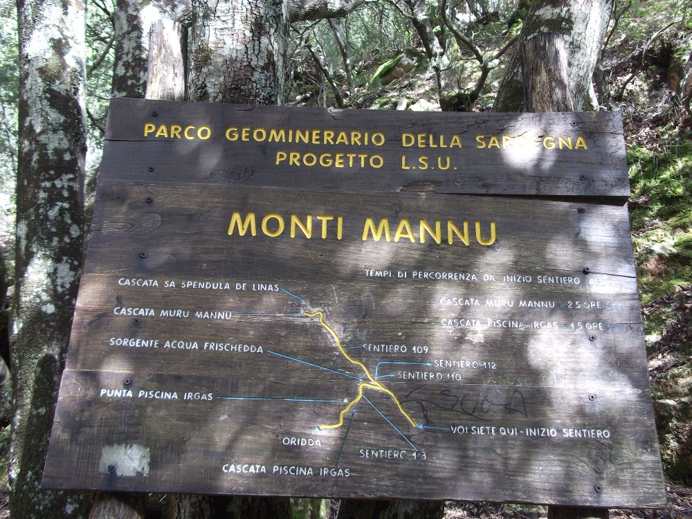
You’ll come across two different types of trail. The red and white, with the CAI technique, which indicate the path 113 – and also the 109, whose first part is in common with the 113.
Path 113 – in its first part, crosses the forest – keeping to the right of the Rio Cannisoni. After about ten minutes of walking you reach the junction between path 109 and 113. Continue to the left, following the sign for the waterfall of Piscina Irgas, and then cross the river using a bridge.
From here the path begins to have a difference in height, with numerous hairpin bends that lead upwards. After about half an hour from the start of the excursion, , you get to a small open space, from which two exits are visible.
The path to the right, however, is the one actually traveled during the excursion, at least for the outward journey. The path, marked by both white and blue signs, allows you to climb further along the mountain, reaching in view, from above, the waterfall of Piscina Irgas, up to a Belvedere indicated by a wooden sign

Going forward the path remains almost in the ridge, but you must be very careful, because it follows an exclusively rocky path and overhangs the gorge below. It is not a difficult stretch in itself, but given the particularity of the terrain and the possible risks should be careful, helping with the hands when necessary.

Continuing on this path you gradually approach the waterfall, until you return to a wooded area, where the descent begins. This stretch is still rocky and is indicated only by stone men, and you should always pay attention to how you go down.
After a few more minutes the trail ends, finding itself exactly at the foot of the Piscina Irgas waterfall.
The total travel time was one hour and three quarters.

For the return, you go down through the hairpin bends and the route of the journey, arriving at the end at the starting point.
Even if not too complicated it is possible – because of the thick vegetation and the signs a little damaged – to lose the correct path. It is advisable to go there with an expert guide. Better to visit them in late spring or early autumn
Time: One hour and 45 minutes
Difficulty: E (Hike)
Path Indication: red and white CAI signpost for path 113. White signpost with blue circle and stone men for the other path 109
Difference in height: +300 m uphill, approx
